

I have written about my trip to OKC last year, and then my follow-up visit to Kansas to take a few more photos on NYE. There is a vast strip of land with deep history (Nemaha County), and I found several abandoned houses and farms just off of Highway 75 in Nebraska, and Kansas.
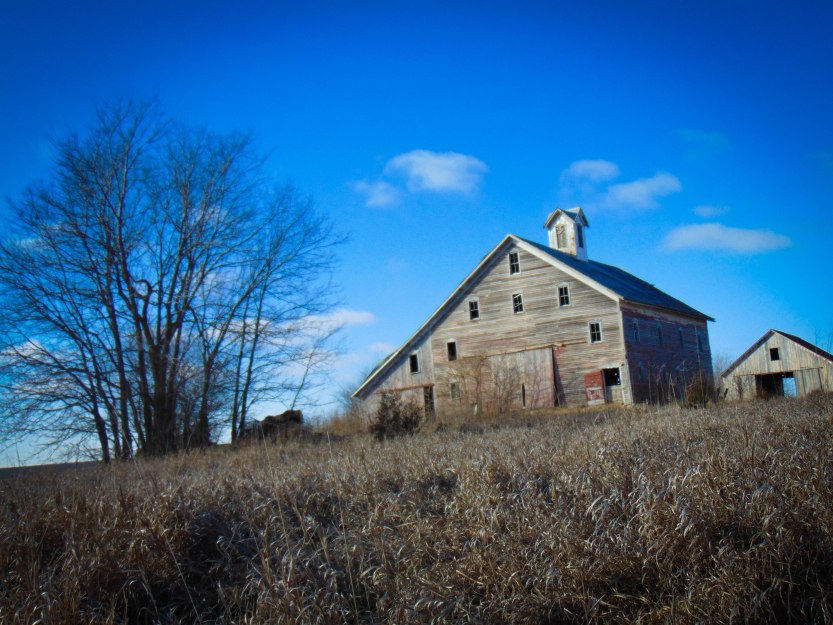
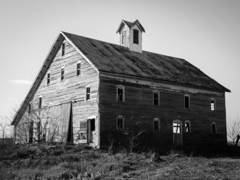
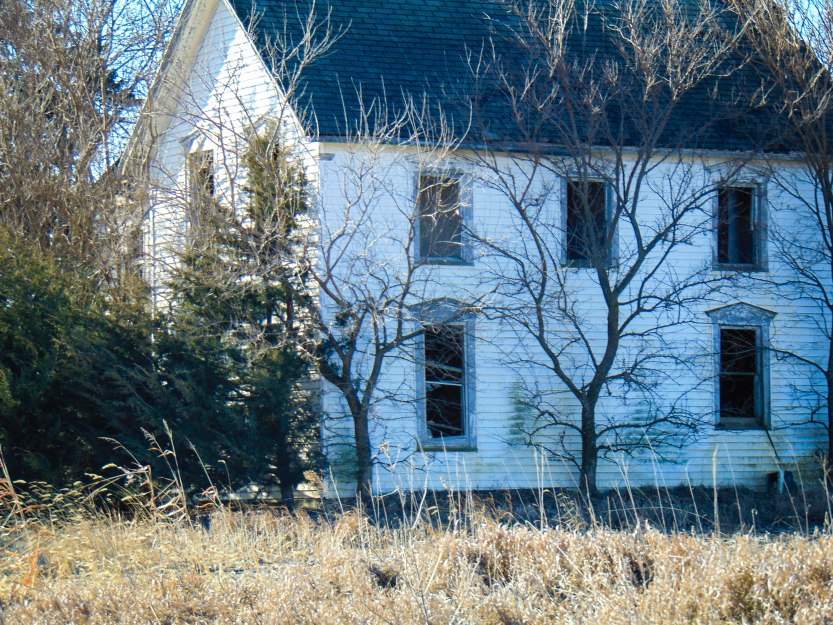
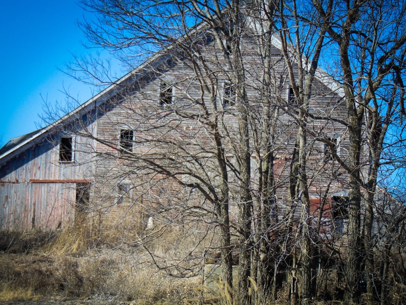
This house is/was located (if it is still there) just outside of Fairview, Kansas, right off of Highway 75, and you can see it from the highway as it’s quite large. There is another abandoned farmhouse on the other side of Bittersweet Road, which I will write a follow-up post about. As I researched the property for a couple of hours, and looked it up on maps and satellite, the address came up as Sabetha, Kansas. While I was positive it was outside of Fairview, I’m just not sure since this is how the address came up: 2387 Bittersweet Rd, Sabetha, KS 66534.
Unfortunately, there is no information or history that I could find on the property so far, without actually visiting the Historical Society or and combing through the local archives. There isn’t even a street view on Google Satellite, which tells me Google has never drive by the property, so it has most likely been long-abandoned.

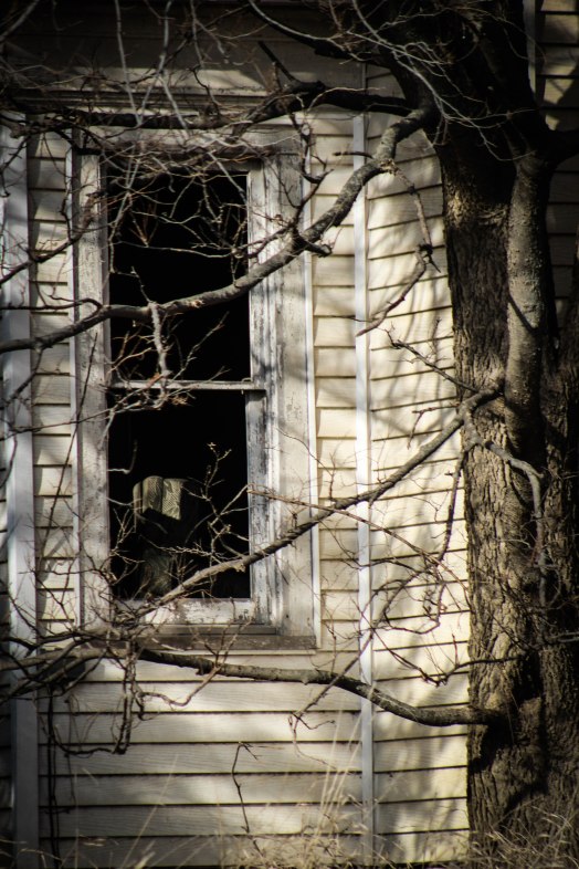
A magnificent, splintered, white farmhouse and creaking barns loom out at the vast Kansas prairie. Shadows of years past watch from the numerous gaping windows, waiting for someone who will never return.


I have added the Google Satellite image of the property.


Named for its charming scenery, Fairview was founded in 1872.
Fairview is just on the outer edge of Nemaha County, Nemaha was an area for the Underground Railroad. Slaves concealed in the homes of sympathizers in daylight, then ferried north across the river at night (to Nebraska City). According to the Nebraska Historical Society, there are two documented sites. For more on Nemaha.


Not far from Fairview is The Lane Trail: County of trail: Nemaha County
Location of marker: Roadside park, 2 miles W. of Jct. US-36 & US-75, 3 miles W. of Fairview
Marker erected by: Kansas Historical Society and Kansas Department of Transportation
Marker text: Near here the towns of Plymouth and Lexington once stood as outposts on the Lane Trail, approximated today by US-75. Named for abolitionist James H. Lane, the trail was established in 1856 to bypass proslavery strongholds in Missouri and provide free-state settlers a safe route into Kansas. Rock piles known as “Lane’s chimneys” marked the trail. Leaving Iowa City, settlers went west into Nebraska and south into Kansas, passing through Plymouth, Lexington, Powhattan, Netawaka, and Holton before arriving in Topeka. The trail also served as part of the underground railroad, used by John Brown and others to transport slaves north to freedom.


I wonder who once lived on this farm, walked the prairie, and took shelter in the barns. Perhaps a runaway slave took temporary refuge here on their way to freedom, maybe many did.


I wish one day to drive by and see this lovely home being restored to its former glory, but until then, I will just hope no one tears her down.


The Kickapoo Tribe also has a reservation not too far.


Categories: Abandoned Barns, Abandoned Buildings, Abandoned Farmhouse, Abandoned Kansas, Trish Eklund
Thrilled to have found this as I was also trying to track down some information this incredible property. I was out for a drive a few hours from home and saw the barn from the highway. Drove back and was so impressed, yet saddened by the decay. It would make a tremendous event space and retreat if the funds could be obtained for the extensive renovation. The house is also stunning. I can see it landscaped, with a new porch and new paint with that massive KS sky as the backdrop.
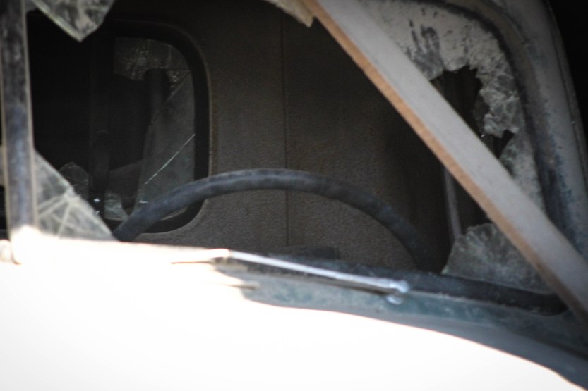
I thought so too! Such a beautiful house and barn! The trucks too.
I believe that is the old Shintaffer farm. There is a photo of the place as it looked in the early 1900s in “A History of Sabetha, Kansas and Surrounding Area 1854-1976,” page 110. The book was complied and published locally and is still available at the print shop in town or at the Mary Cotton Public Library. There are four generations of the Shintaffer family buried in the Sabetha Cemetery.
Elizabeth, that’s amazing! I looked for the book and could not find where I could purchase it. I will probably have to go there to get it! Thanks for telling me about it!
It is on the intersection at 11th and Main. I think it’s called Printing Impressions . The owner and her husband should know a good bit about the town history. Other good sources are Cindy Baker, who runs 1005 Salon on Main Street and Dr. Simpson, the chiropractor whose office is also on Main. Did you look at the find-a-grave entries for the Shintaffers?
Looking closely at your photos, I noticed that the house seems to have been sided with vinyl or steel. That would suggest someone living there until fairly recently. It has probably helped preserve the structure. The ridge poles on both the big barn and house are still true. It’s a beautiful farmstead. I have always admired the place and very much enjoyed finding your photos.
Have you spent any time in Fairbury, Nebraska? That is my hometown. It is declining rapidly, I’m afraid, but was breathtaking in its day.
I was just about to say never mind, I contacted them and found out which one! Thanks so much for your help! I will totally try and stop to talk to Cindy Baker! There is also another abandoned house not far down from that one. I am going to try to find more information on that one as well. I did find them on Find-a-Grave and took pics of what I found so I can hopefully find them easier tomorrow! Thanks so much for your help!!
I have taken some photos of some places around Fairbury. I like that area! There is one farm kind of close to Fairbury in my book. I will let you know tomorrow what I find out!!